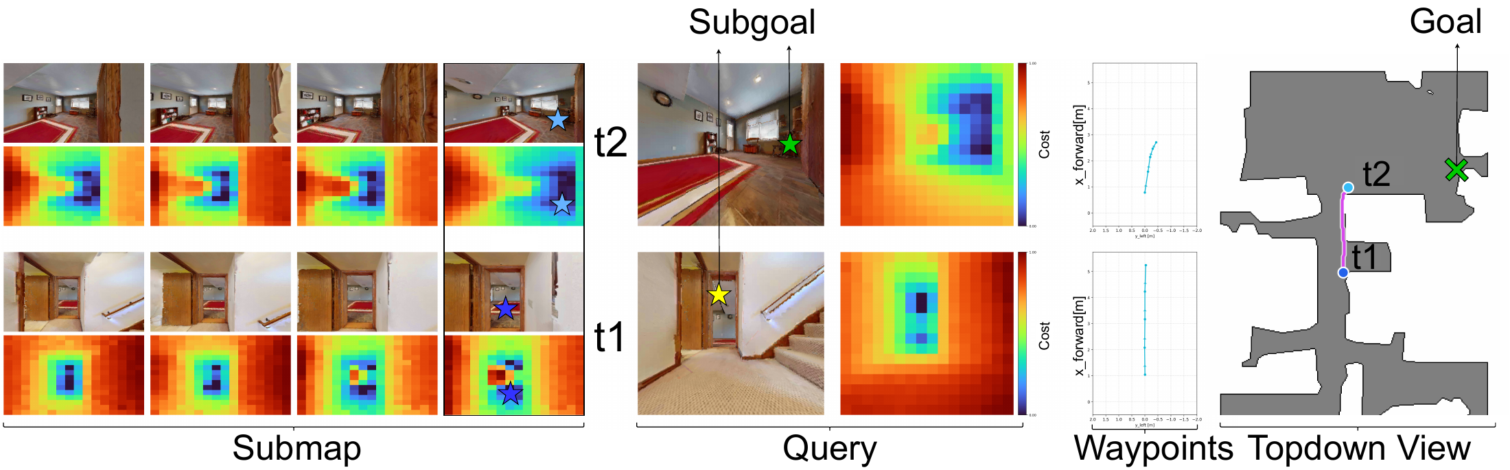
- Plann3r, a method to predict planning costs in the form of pixel-level geodesic distances for a query image to an arbitrary subgoal pixel given within a submap.
- VGGT-Nav, a single-camera visual navigation pipeline that leverages 3D grounded backend for mapping, localization and planning, which enables improved control prediction and navigation success rates across multiple tasks of a prior-traversal (seen-environment) navigation benchmark.
- Simultaneous localization and planning. Plann3r enables simultaneous mapping/localization and planning as the query costmap is implicitly based on query-to-submap cross-attention; this forgoes the need for explicit pairwise feature matching which is more prone to failures.
Method
Plann3r architecture
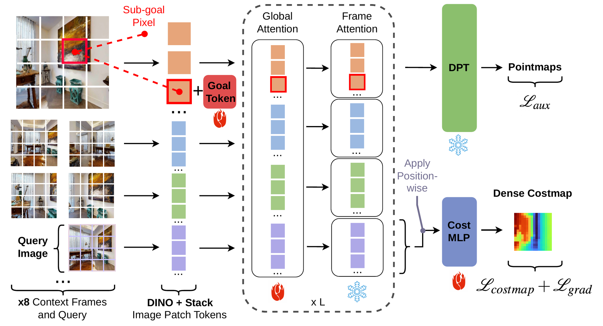
We build Plann3r on top of a pre-trained VGGT model, fine-tuning it to predict geometrically consistent planning costs in terms of geodesic distances from an image pixel to a (sub)goal pixel given within a submap of images.
The VGGT-Nav pipeline
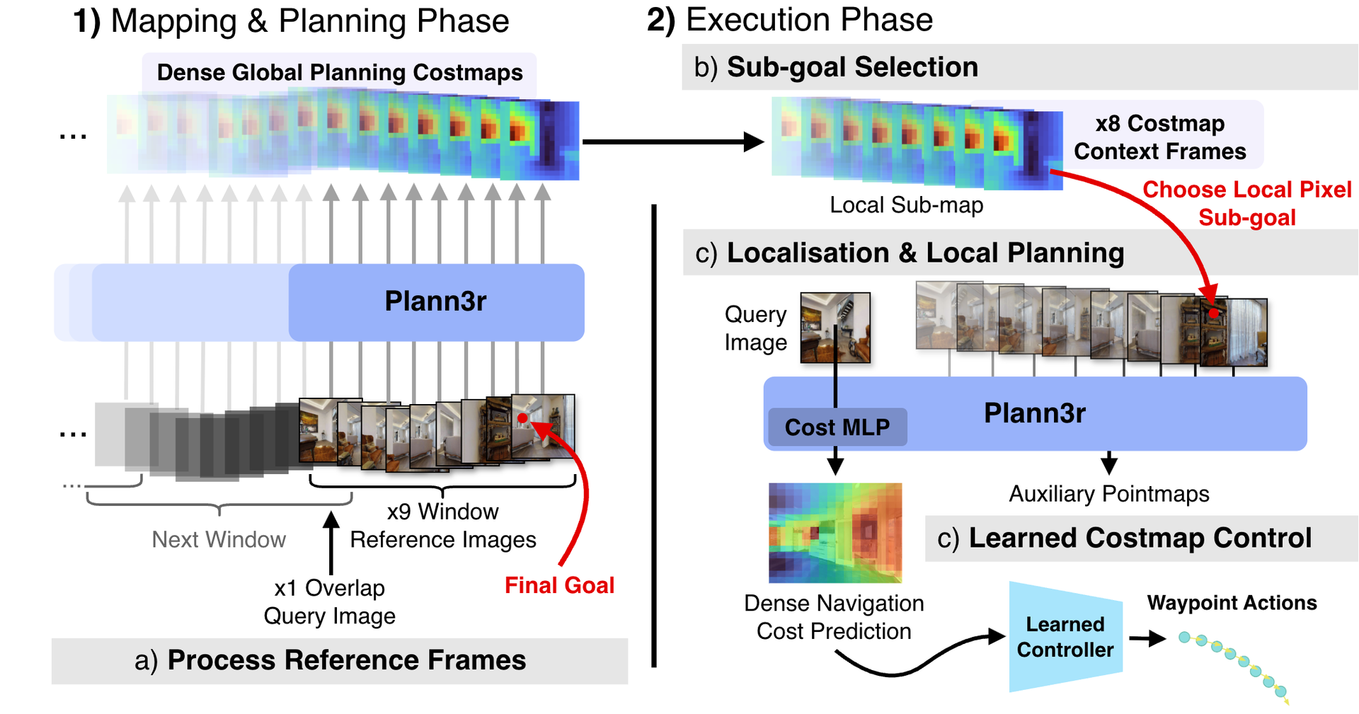
We use the proposed Plann3r, based on VGGT, to predict planning costs in terms of geodesic distances from query image pixels to an arbitrary (sub)goal pixel given within a submap. Plann3r is used iteratively both during the offline mapping cum global planning phase and the online execution phase of localization cum local planning, where the output costmaps from the latter are used to predict egocentric trajectory.
Offline: mapping and global planning
Functional map of costs
Plann3r predicts local planning costs on a submap around the goal image. The lowest-cost patch of the image shared with the next submap is the next subgoal, and its cost is added as an offset to the next window. Repeating this back to the start gives every reference image a costmap of global planning costs to the goal, without a 3D occupancy grid or a topological graph.
Online: localization and local planning
Cost-conditioned control
The robot retrieves a submap of 8 reference images, and the subgoal pixel is the minimum cost in their precomputed costmaps. Plann3r takes the query image, the submap and the subgoal together, so its global attention localizes the query without explicit feature matching. A controller with the architecture and training of ObjectReact turns the query costmap into 5 future waypoints in the local BEV space.